
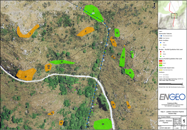
The Lyttelton – Woolston fuel pipeline (LWPL) is a 7.5 km long, above ground pipe which crosses the Port Hills between storage depots at Lyttelton (south) and Woolston (north) in Canterbury. The pipeline was constructed around 1955 – 1956 and is a critical link that provides petroleum fuel products to Christchurch and a large part of the South Island of New Zealand. As such, the pipeline is of high value to the client and community. The pipeline is located on steeply sloping topography with multiple rock outcrops, tunnel gully features, and landslide scarps. These hazards pose a significant risk to the pipeline and have the potential to compromise the safe operation of the pipeline.
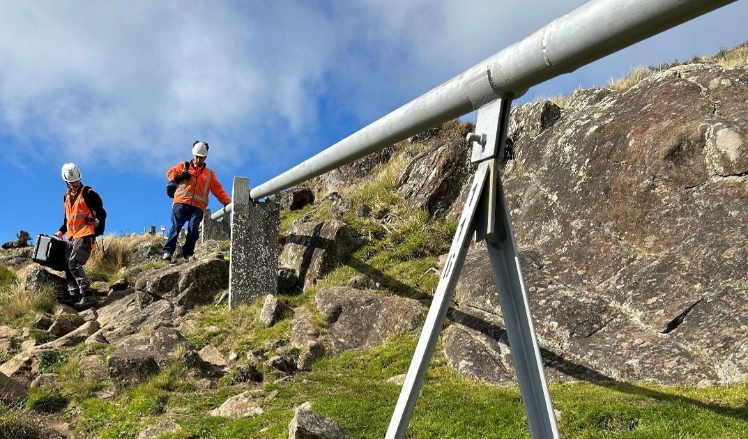
For the first stage of the project, ENGEO was engaged to perform a slope stability hazard assessment along the pipeline route. This involved a walkover and drone survey of the pipeline to identify rockfall sources, tunnel gullies, and landslide features that the pipeline was exposed to. We provided recommendations on required remedial works and ongoing monitoring regime.
The second stage of the project, ENGEO established a trigger action response plan (TARP) for the client. The purpose of the TARP is to develop a structured response to slope instability triggering events i.e., rainfall and seismic. To reduce the reliance on ENGEO or the client having to manually monitor seismic and rainfall events, an automated monitoring system was developed. The alert systems send an alert to the relevant people when seismic or rainfall events exceed threshold magnitudes so that appropriate actions can be undertaken.
Due to the importance and sensitivity of the pipeline, the client requires constant monitoring of possible slope instability triggering events. To assist with monitoring, a seismic and rainfall alert system was setup. ENGEO undertook the task of developing the seismic alert system while NIWA helped setup the rainfall alert system. ENGEO developed an inhouse monitoring system using SharePoint to read live streamed peak ground acceleration (PGA) values from two nearby GeoNet seismic stations. If PGA values exceed curtained thresholds, an automated email alert is sent out to the relevant parties so the necessary actions can then be taken.
To spatially communicate ENGEO’s observations from hazard mapping during pipeline walkovers, we used an online GIS portal where any features/hazards identified are displayed for the client to view. The GIS portal allows the client to view hazards identified and query each feature to review any notes and photographs taken during our assessments. The portal reduces the need for traditional reporting and provides a better means of communicating changes to the hazards in a timely manner.